scientific diffusion Seminars and Agenda TerraView Social Policy – Software and Geoprocessing Course
TerraView Social Policy – Software and Geoprocessing Course
GIS (Geographic Information System)
The GIS (Geographic Information System) maintained by the CEM comprises more than 40 integrated databases, and was developed to help general users who could not count on public access to territorial information for more than two decades.
In order to allow more non-specialized users access to the data, CEM and INPE developed a free version of the software TerraView. CMS also promotes regular courses on geoprocessing, attended mostly by professionals connected to or working for public agencies.
Software TerraView Social Policy – Software and Geoprocessing Course
The new software TerraView Social Policy 4.2.2 launched in May 2014 and greatly increases the scope of possibilities for GIS technology. With a new layout, new tools and facilities for importing files, the new version of TerraView Social Policy (originally launched in 2007) is an important support in research that aims to better understand of the spatial relationships and the place of the data.
The new version of TerraView Social Policy 4.2.2 expands the opportunities to work with many different types of cartographic files and helping facilitate presentations, with the results containing numerous studies.
Available for free on the CEM website, the geoprocessing software TerraView Social Policy 4.2.2 produces spatial analysis from demographic, economic and social data. The possibility of access to TerraView - Social Policy is part of a partnership between the Center for Metropolitan Studies and the Image Processing Division of the National Institute for Space Research (DPI -INPE).
The application is part of the TerraView family of software, developed by INPE, and allows the user to view and explore geographic data. TerraView Social Policy has been customized by an institutional arrangement involving INPE, CEM and a private initiative through a company hired to develop the product from the free software. The software focuses especially on the area of social policies (education, health, housing and income transfers).
This partnership focuses mainly on attracting new researchers, technicians of the municipal administration, undergraduate and postgraduate students, and other professionals, presenting new insight into the importance of producing spatial analysis and interpretations about the social reality of our urban areas.
The creation of maps and charts is made from census data from IBGE (Instituto Brasileiro de Geografia e Estatística), which, when crossed with specific information (indicators, for example) allows the identification of points to be ascertained.
To download the new software TerraView Social Policy, click here.
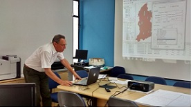
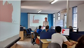
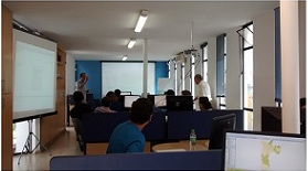
For those interested in deepening their knowledge on the software, CEM also offers a course on GIS for the Software TerraView Social Policy. This course helps participants learn how to use basic tools, enabling them to explore the databases and to generate maps and graphs. Learn more about the course.
The course is in the classroom mode.
Geoprocessing Course to TerraView Social Policy software
As part of this project, the CEM offers a course for the geoprocessing software TerraView - Social Policy for non-specialists interested in deepening their knowledge about the software. During the training, participants will have an overview of the system, learning to use basic tools, learning to explore the databases and generate maps and graphs. Between April 2007 and June 2017, 807 professionals and students, who work in the areas of education and housing, participated in the training.
Access the application form (Click here to access the form)
Topics covered in the training:
- Introduction: Fundamentals of Geoprocessing
- Program Structure: Databases, Information Plans, Views and Themes, Importing Vectoral Data, Selecting Objects
- Basic Analytic Tools: Spatial search, searches by attributes, thematic maps, graphics
- Working with attribute tables: Importation and integration of data originating from Data Tables of Various Origins, selection of data in a table, working with a grade area
- Geographic operations: Aggregations, sums, intersection, difference, attribution of data for location, collection, distribution, creation of areas of influence
To participate in the TerraView Social Policy training course, participants are not required to have prior knowledge of GIS. This program is geared for professionals and students with basic knowledge of computer and internet usage.
The participants will receive:
- Material with examples used in the course
- CD with the Terra View Social Policy Software and Databases
- Course certificate
Total Course Hours: 20 Hours
Software, manual e bases de datos:
Faça o download clicando abaixo:
- Software TerraView Política Social 4.2.2:
- Bases de dados utilizadas no curso introdutório:
- Bases de Dados para o curso TerraView Política Social (arquivo no formato .zip 56.096 Kb). O arquivo ZIP contém: Bases de dados para Curso TerraView Política Social, Bases Vila Mariana, Bases Brasil
Indicação para pesquisadores:
Para citar o TerraView Política Social, sugerimos esta forma:
CEM. CENTRO DE ESTUDOS DA METRÓPOLE. TerraView Política Social versão 4.2.2. São Paulo: CEM, 2014. Disponível em: www.centrodametropole.org.br
Horário do curso:
No primeiro e no segundo dia: das 9 às 18 horas
No terceiro dia: das 9 às 13 horas
Location:
CEM/CEBRAP
Morgado de Mateus St., 615 - Vila Mariana (close to Ana Rosa subway station)
Valores:
A capacitação Geoprocessamento para o software TerraView – Política Social é realizada graças ao apoio das instituições e agências de fomento à pesquisa que financiam o Centro de Estudos da Metrópole. Graças a este auxílio o curso é oferecido com os valores a seguir e que visam ao custeio das despesas básicas para a sua efetivação.
- Para o curso de junho/2018, no caso de pagamentos até o dia 13/6/18 o valor é R$ 500,00.
- Para pagamentos do dia 14 ao dia 26/6/18, o valor é R$ 600,00.
Dados para pagamento:
- Efetue depósito na Conta Corrente: 123739-X, Agência: 0300-X – Banco do Brasil, em nome do Centro Brasileiro de Análise e Planejamento (Cebrap), CNPJ do Centro Brasileiro de Análise e Planejamento (62579164-000172).
- Envie o comprovante de depósito via fax ou e-mail aos cuidados de Daniel W. T. da Silva. Fax. (011) 5574-5928 ou e-mail para danielt@cebrap.org.br (*)
(*) Em caso de cancelamento do curso o aluno será reembolsado integralmente ou transferido, a seu critério, para o próximo curso programado. Porém, em caso de desistência do curso por parte do aluno, o reembolso será de 50% do valor depositado.